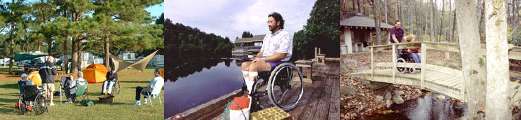


Coastal Virginia Accessible Trails
Suffolk
Dismal Swamp Canal Trail
Link to map of trail in PDF format.
Description: This 8 mile trail was built on a former state highway so it's a wide, paved and flat pathway along the Dismal Swamp providing scenic views and the chance to see many types of birds and other wildlife, and it's a resting spot for thousands of migratory birds in the fall and spring. George Washington's company surveyed part of the Dismal Swamp and it also served as a stop on the Underground Railroad.
Directions: 1200 Dismal Swamp Canal Trail, Chesapeake, VA 23323 Follow US 17 Business/George Washington Highway south from Chesapeake. The north trail head is located at the intersection of Dominion Blvd. and Old Rt. 17 in Chesapeake, VA
Additional Information: Parking at the northern trail head will be will be on the right, just before the road curves toward US 17's main alignment. For the southern trail head parking, turn right onto Ballahack Road. There is limited parking along the trail and a short stretch is still open to traffic.
There is substantial shade for much of the length. There are two new rest room buildings with water fountains at 0 and 3.5 miles.
The Dismal Swamp Area has one of the largest concentrations of Black Bears in the state. Most sightings are usually late afternoon or early evening/sunset and are concentrated between Cornland and Glencoe Rds. and the last two miles of the Trail, next to the farmer's fields. However, bears can be seen anyplace and at anytime.
Virginia Beach
VB Park Finder App
Link to Virginia Beach Bikeways and Trail Map in PDF format
Link to City Parks Map in PDF format
Dam Neck Road Trail
Description: The 8-mile asphalt and concrete-paved trail passes among a few neighborhoods along the way but does cover more open countryside than many of the Virginia Beach area trails.
Directions: Salem Rd. to Terrier Ave. (NAS Oceana Annex)
Additional Information: The trail has no official parking. You have to access it by local streets and sidewalks or through the General Booth Boulevard Trail. Parking may be available at the shopping plaza on General Booth Boulevard, the elementary school east of that intersection, or the shopping plaza between Princess Anne Road and Rosemont Road.
Diamond Springs Road Trail
Description: The one-mile concrete trail runs parallel to Diamond Springs Road between Wesleyan Drive and Northampton Boulevard and links neighborhoods with shopping southwest of Little Creek Reservoir. You can also connect with the Wesleyan Drive/Haygood Road Trail.
Additional Information: Park at Cypress Point Shopping Center at the south end of the trail.
General Booth Boulevard Trail
Description: The 6 mile paved trail runs parallel to General Booth Boulevard between Princess Anne Road and Norfolk Avenue. The General Booth Boulevard Trail provides access to parks, neighborhoods, shops, and the beach. Where the trail crosses Nimmo Parkway, you can go east to pick up the Nimmo Parkway Trail, and at Dam Neck Road, you can pick up the Dam Neck Road Trail.
The trail ends near the sea in downtown Virginia Beach. From here it's about two blocks east to the Virginia Beach Boardwalk.
Additional Information: Park anywhere in downtown Virginia Beach near Norfolk Avenue.
Great Neck Road/London Bridge Road Trail
Description: Covering 11.5-miles, this paved trail begins in the busy commercial area just south of Shore Drive/US 60 in Virginia Beach. From Shore Drive, the trail continues parallels Great Neck Road through residential and retail areas.
South of Frank W. Cox High School, follow the sidewalk west along Shorehaven Drive to reach Great Neck Park. The large parks offers views of Lynnhaven Bay, wooded nature walks, and has a playground, along with rest rooms and vending machines.
Virginia Beach Boulevard is a busy intersection with no crossing signal. So be aware if you want to continue on the trail, you'll need to negotiate this obstacle. The south end of the trail goes by the Naval Air Station Oceana. If you wish to do shop or eat, you can take the sidewalk along International Parkway to reach Lynnhaven Mall.
The trail ends at the Shipps Corner Road intersection, but picks up again farther south at Dam Neck Road. It continues to General Booth Boulevard, next to the Strawbridge Marketplace, where the General Booth Boulevard Trail begins its route northward to the waterfront and popular Virginia Beach Boardwalk.
Directions: You can park at several locations: First Landing State Park (2500 Shore Drive) Great Neck Park (2513 Shorehaven Drive) Lynnhaven Mall (701 Lynnhaven Parkway) Strawbridge Marketplace (2129 General Booth Boulevard)
Additional Information: Because this is a long, urban trail, you may find it more convenient to park at one of the suggested locations and use the trail around that area.
Independence Boulevard Trail
Description: This trail The trail runs along to S. Independence Boulevard in two separate sections.
The northern part runs between the Timberlake neighborhood at Green Meadows Drive to Lynnhaven Parkway. You can pick up the Lynnhaven Parkway Trail to reach Lynnhaven Mall. The southern part goes from the Salem Road Trail at Independence Boulevard west to Indian River Road/State Route 603. Stumpy Lake Golf Course & Natural Area is located just north of the western endpoint. Stumpy Lake Natural Area consists of a 278-acre lake with a raised ADA compliant overlook.
Directions: Indian River Rd./SR 603 and Independence Blvd. to Green Meadows Dr. and Independence Blvd.
Additional Information: You need to park on local streets, schools and parks.
Kempsville Road Trail
Description: One in a series of suburban trails in the Virginia Beach area for non-motorized use, this 7-mile paved trail runs parallel to Kempsville Road between Providence Road and Battlefield Boulevard. Near the south end is Great Bridge Lock Park; on the north end you'll find Providence Park. The trail passes through several neighborhoods, shopping plazas and parks.
Directions: Providence Rd. (SR 40) to Battlefield Blvd.
Additional Information: The trail has no official parking. You have to access it by local streets and local shopping malls.
Little Neck Road Trail
Description: One of the suburban trails in the Virginia Beach area, the 3 mile asphalt and concrete trail runs parallel to Little Neck Road between W. Little Neck Road and Virginia Beach Boulevard (US 58).
Additional Information: The trail has no official parking. You have to access it by local streets and local shopping malls.
Lynnhaven Parkway Trail
Description: The 6 mile trail runs parallel to Lynnhaven Parkway between Lishell Place and Stewart Drive and connects suburban neighborhoods with shopping, schools and parks. You can also link to the Salem Road Trail, Rosemont Road Trail and Independence Boulevard Trail. The Lynnhaven Parkway Trail
Additional Information: The trail has no official parking. You have to access it by local streets, schools and parks.
Nimmo Parkway Trail
Description: A 1 and a half mile asphalt and concrete suburban trail in the Virginia Beach area, it runs parallel tinamou Parkway between Albuquerque Drive and just a little west of Newstead Drive, linking neighborhoods with the Red Mill Commons shopping mall. It continues to a less-developed wooded area and connect with the short Upton Drive Trail to access the mall.
Additional Information: The trail has no official parking, but you cab park at Red Mill Commons shopping area and access the Upton Drive Trail to link to the Nimmo Parkway Trail.
Rosemont Road Trail
Description: The trail is one of the city's suburban trails going parallel to Rosemont Road between Holland Road and Whiteberry Lane. It's 3 and half miles long and paved all the way in either asphalt or concrete going through among neighborhoods and past shopping malls and light industrial areas. You can pick up the Lynnhaven Parkway Trail at Lynnhaven Parkway.
Additional Information: The trail has no official parking. You have to access it by local streets and sidewalks.
Salem Road Trail
Description: Almost a mile and half paved suburban trail, it runs parallel to Salem Road between South Independence Boulevard and Princess Anne Road. The trail links neighborhoods with local parks and shopping along a undeveloped urban corridor.
Additional Information: The trail has no official parking. You have to access it by local streets and sidewalks. You may be able to park in some shopping plazas.
Upton Drive Trail
Description: Although this trail is only a half-mile long, it runs parallel to a short section Upton Drive between Nimmo Parkway and Princess Anne Road, just east of the Red Mills Commons Shopping Plaza, and connects to the longer Nimmo Parkway Trail.
Additional Information: You can park in the Red Mill Commons shopping mall.
Virginia Beach Boardwalk
Description: One of the most popular trails in the city, it's a scenic, ocean-front trail that's busy with pedestrians, cyclists, and joggers in the summer. You can enjoy the shops and beach along the 40th Street on the north and Rudee Inlet on the south. You'll find plenty of things to see and do, so take your time and enjoy the scene no matter what season of the year.
Additional Information: Many places to park downtown, but there is a fee.
Wesleyan Drive/Haygood Road Trail
Description: The trail runs parallel to Wesleyan Drive/Haygood Road between Independence Boulevard and Baker Road. The3-mile concrete trail links schools, neighborhoods and parks south of Little Creek Reservoir. You can also connect with the Diamond Springs Road Trail.
Additional Information: You can park at Cypress Point Shopping Center near Diamond Springs Road and at Bayside High School, but there may be restrictions may apply at both places.
Williamsburg
Powhatan Creek Trail
Description: Located in western Williamsburg, the asphalt trail goes 2 miles from the historical Jamestown Settlement attraction to Clara Byrd Baker Elementary School.
Directions: Parking is available at the Jamestown Settlement (2110 Jamestown Road) and at Clara Byrd Baker Elementary School (3131 Ironbound Road).
Additional Information: The trail starts out in a large field and then goes through a housing development. At the creek, the trail goes through the wooded area you will cross wooden bridges and follow the creek. There are some hills.
Virginia Capital Trail
http://virginiacapitaltrail.org/
Link to interactive trail map.
Link to trail map in PDF format.
Description: This is a 52 mile paved pedestrian and bicycle trail that connects Jamestown and Richmond along the Scenic Route 5 corridor.
The southern end of the trail is the Greensprings segment beginning near the Jamestown Settlement. It gives a glimpse of early American history, Revolutionary War battlegrounds wooded wetland and wildlife along the way.
The Chickahominy Riverfront part starts at the intersection of SR 5 and Greensprings Road (SR 614) and goes to the Chickahominy Riverfront Park. You will see lovely views of the James and Chickahominy Rivers.
The Charles City County section passes many colonial plantation homes, including two presidential homes, Sherwood Forest Plantation, home of President John Tyler, and Berkeley Plantation (just off Harrison Landing Road). home of Presidents William Henry Harrison and Benjamin Harrison.
The New Market Heights portion runs near the Shirley Plantation, one of the oldest plantations in the state and a National Historic Landmark.
The Park Phase is s a 3.5-mile horseshoe going away from State Route 5, connecting wit Dorey Park, a popular spot with many recreational amenities, including a playground, sports fields, tennis courts, disc-golf course, picnic areas, a nature trail, a fishing pond, and an off-leash dog park.
The Varina part goes by Henrico County’s Four Mile Creek Park, a wooded outdoor park that was named for Varina Farms, a plantation established by early English settler John Rolfe, who married the famed Pocahontas.
The Richmond Riverfront segment, at the northern end of the trail, begins at the Canal Walk and ends at Great Shiplock Park, which commemorates the canal lock built here in the 1850s. It goes through Shockoe Bottom, one of the city's oldest neighborhoods. It
Directions: Park at the Jamestown Trail head off SR 31; Chickahominy Riverfront Park (1350 John Tyler Memorial Highway) or Jamestown High School (3751 John Tyler Highway); Charles City County Visitors Center (10760 Courthouse Road); Herring Creek Park segment at Dorey Park (2999 Darbytown Road); Varina at Four Mile Creek Park; Richmond Riverfront at Great Shiplock Park (intersection of Pear and Dock Streets).
Additional Information: Amenities for the various sections of the trail are available as follows: Greensprings has rest rooms and picnic tables. Chickahominy Riverfront Park has rest rooms and picnic areas are available in the park. Charles City County Visitors Center has rest rooms.
Trail markers every mile keep you feeling very connected to where you are. It's a long trail and on the Varina to Richmond section and the Charles City to New Market section, there aren't a lot of places to refill water bottles, go to the bathroom, or buy food.
There is plenty of trail head parking at various spots along the trail for shorter rides.
<<<back to Accessible Trails
Home | Regions | Virginia Weather & Maps | Resources | Outdoor Recreation | About Us | Contact Us | Accessibility Links

