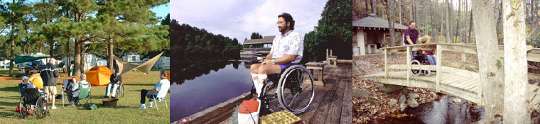


Southwestern Virginia/Blue Ridge Highlands Accessible Trails
Blacksburg
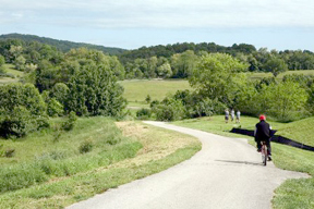
Huckleberry Trail
Description: This scenic asphalt trail is almost 8 miles long, a mix of college town, rural, and rolling landscapes starting in Blacksburg The trail starts in the a residential neighborhood at the Blacksburg Area Branch Library in downtown Blacksburg, across from the Virginia Tech campus. Once you finish the trail, be sure to visit this beautiful college campus with its Hokie stone buildings.
Photo courtesy of Town of Christiansburg, VA
Meandering through the town, the trail goes past homes and through open fields and forests. At State Route 460, the Huckleberry as it heads southeast along the highway, so make sure you stay on the trail. Otherwise you end up on the roadway or farm fields. Some rider may find it to be a bit hilly between miles 3 and five.
At mile 4 The Coal Miner's Heritage Park is right before you reach a railroad bridge that passes over the still-active Norfolk Southern rail line. The park has old mining equipment. Most of the trail has easy curves and slopes as the story goes that the old trains supposedly slowed down enough for so the Virginia Tech Cadets could hop from the cars and pick huckleberries before the train gathered more speed.
Unlike most rail-trails, this trail has many gentle curves and slopes, providing diversity in your trail experience. In fact, it is on these steeper sections that the old trains were said to have slowed down enough for the cadets to hop from the cars and pick huckleberries before the train gathered more speed.
The trail ends north of New River Valley Mall in Christiansburg. One path is up the steep hillside to the mall-side pocket park, but it’s better to branch around the base of the hill that runs along side the active rail line. A bridge over SR 114 connects the trail that runs behind the mall stores to Cambria Street. The trail ends at the Christiansburg Recreation Center at Cambria St. NW and N. Franklin St.
Directions: To reach the trail’s downtown beginning, take US 460 toward Blacksburg and turn onto Main Street, stick to US 460 Business route, going north. Turn left on Miller Street and drive three blocks to Harrell Street, where street parking is available. The trail begins in the library parking lot on Miller Street. However, avoid using this lot; towing may be enforced for trail users parked here.
Navigating the trail from New River Valley Mall to Blacksburg, take US 460 toward Christiansburg and turn right on State Route 114/Peppers Ferry Road. The mall is on the right on New River Road. Follow New River Road, which loops around the mall; trail parking is at the back of the mall. Parking by the movie theater is flatter.
Additional information: The trail gets its name from a railroad nicknamed “the Huckleberry” that transported coal, mail and passengers to Virginia Tech. The Corps of cadets called Blacksburg "Huckleberry Junction" because of huckleberries growing in abundance along the railway. In fact, the area became famous for huckleberry pies and jams. Even today you can find huckleberry bushes around the trail information kiosks.
Damascus
Beartree Lake
Link to information with photos.
Description: The Beartree Recreation Area has a small lake with a paved loop trail that’s wheelchair accessible and an accessible fishing pier. The area also has sites for RV's and camping.
Directions: From I-81 Southbound: Take exit 29 at Glade Spring, turn left at bottom of ramp and go about ¼ mile to traffic light at intersection of Rt. 91 and Rt. 11. Then proceed straight through the traffic light and follow Rt. 91 for 13 miles to the Beartree entrance on the left (paved FS 837).
From I-81 Northbound: Take exit 19 at Abingdon onto US 58 east. Go about 12 miles to Damascus. Continue on US 58 east another seven miles to the campground entrance on the left. From the entrance off US 58 to the entrance station is approximately one mile. The family campground loops are approximately three miles from the entrance station, and the group camping loops are approximately ½ mile from the entrance station.
Creek Junction Accessible Fishing Trail at Whitetop Laurel Creek
For additional information on the traill, please contact the Mount Rogers National Recreation Area at: 276-783-5196.
Description: Part of the Mount Rogers National Recreation Area, this trail is an accessible fishing trail with piers constructed over the creek for wheelchair access on one of state's largest wild trout streams. You’ll have the chance to catch brook, brown, and rainbow trout in the beautiful Southwest Virginia mountains.
The special regulation sections are fully accessible recreation facilities with wildlife viewing platforms and streamside wheelchair accessibility.
Directions: From I-81 Northbound: Go through Damascus and continue on Highway 58 for approximately 9 miles to a sharp right turn off Highway 58 that leads down to the Creek Junction Accessible Parking Area on the Virginia Creeper Trail. Go about 1.5 miles to the parking area down the narrow gravel road.
From I-81 Southbound: Take exit 35 at Chilhowie and turn left onto Rt. 762 and travel approximately 10 miles (Note that Rt. 762 becomes Rt. 600 at the blinking yellow light). Turn right on Rt. 603, travel about 3.5 miles to the junction of Rt. 603 and Highway 58. Go straight on Highway 58 to the second road on the left which continues about one mile down a narrow, one lane and unpaved road to the parking area.
Additional information: While easily accessed from Highway 58, the gravel road is not recommended for trailers or RVs. Take your own supplies and water. Cell phone coverage may be spotty.
Galax
New River Trail State Park
Link to trail map in PDF format.
Description: One of America's premier rail-trails, New River Trail State Park is 36 miles long of crushed, packed stone that is part of the National Recreation Trail by the US Department of the Interior. The park trail goes through Grayson, Carroll, Wythe and Pulaski counties along the New River, the second oldest river in the world, geologically speaking.
The easiest part of the trail for persons using wheelchairs is marker 52 in Galax to the dams on the New River. Free parking in Galax can be found near the visitor center and bluegrass theater. The trail beginning has an old red caboose, and then you follow the path to scenic Chestnut Creek about 12 miles through a railroad tunnel and the beautiful Fries Junction trestle bridge across the New River to the Fries Junction section. When you cross the bridge you have the choice of going into Fries, a 12-mile roundtrip, or heading north toward Pulaski.
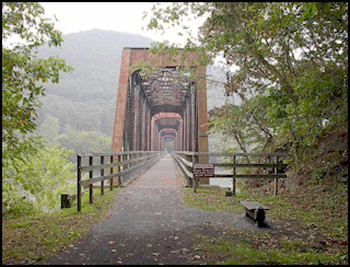
Photo by Virginia State Park Staff
For those wanting a challenge, the majority of the trail to Pulaski (Dora Junction), covers almost 25 miles with he first 3 miles going uphill. Traveling along the peaceful New River as it flows through Cripple Creek Junction, Foster Falls and Allisonia, you'll see many cavernous tunnels, steep dams, and trestle bridges. A mile before Draper, it's downhill to the 950-foot Hiawassee trestle around mile marker 8. The trail is isolated for much of this journey, so if you are on this stretch, be sure to have your cell phone, food, and water plus carry all necessary supplies in case of an emergency or quick equipment repair.
Directions: For the Galax trail beginning, take Interstate 77 to the US 221/US 58 Exit (Exit 14) toward Hillsville/Galax. The trailhead is located on the right, where US 58 crosses Chestnut Creek.
To access the trail in Fries take I-77 to the US 221/US 58 Exit (Exit 14) toward Hillsville/Galax. Turn right at Cliffview Road/SR 721 to Fries. SR 721 becomes Fries Road before crossing the New River. As you come into town, turn left on Dalton Road. The trail begins at the bottom of the hill with prominent signage. Parking is near the town park on Riverview Avenue.
For the Dora Junction trail beginning in Pulaski from I-81, take State Route 99 west for 2 miles toward Xaloy. Turn right on Xaloy Way and look for the trailhead on the right.
Additional Information: This trail offers great scenic views especially in the fall when the leaves are turning. Also this is a very popular horse trail. Be aware if equine etiquette. Horses have an almost 360 degree vision. They also have two blind spots right in front and directly behind them. Don’t race up behind a rider, you need to ask permission to pass and do so slowly. Otherwise you risk getting kicked or initiating a spook that could cause the rider a nasty accident. And yes, watch out for the manure.
New Castle
Fenwick Mines Wetlands Trail
Description: Located about 7 miles from New Castle, this is a one-mile wheelchair accessible trail of crushed limestone with wood edging that winds through woods and across wetlands. The trail was designed especially for people with disabilities and goes though a oak-hickory forest into a wetland with trees and finally into a marsh. It’s an excellent area for bird watching and seeing native wildlife.
There are picnic tables and shelters, grills, and wheelchair accessible restrooms.
Directions: From New Castle, drive 5 miles north on VA 615. Turn left on VA 611 and go .5 mile. Turn right on VA 685 to enter recreation area. Parking area for trails is about 1 mile, on right. For picnic area, continue .5 mile and turn right on FR 229. Picnic area is on the right. Mine trail is just past the picnic area, on left.
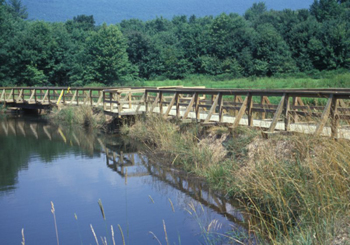
Photo courtesy of USDA Forest Service
Fenwick Nature Walk
Description: This trail is a self-guided one-mile interpretive loop along an old railroad grade and Mill Creek. It’s nicely done for persons with disabilities and is an easy trail to navigate with shady trees and cool waters, refreshing on a hot day.
Directions: From the Craig's Creek Recreation Area at Oriskany, VA, return west on Rt. 817 to Rt. 615. Turn left and travel south 6.8 miles to Rt. 611. Turn right and go 0.1 miles to Rt. 685. Turn right and continue 1.3 miles to park on the right.
St. Paul
Oxbow Lake Park
Description: This is a city park with a paved one-mile accessible trail. There are rest rooms at the parking area. It’s a wonderful place to watch dragonflies, butterflies, hummingbirds, duck and geese.
Directions: Take US 58 ALT to the Town of Saint Paul. Turn at the intersection of SR 63 and US 58 ALT for 0.1 miles and turn right into the parking area for Oxbow Lake Park.
<<<back to Accessible Trails
Home | Regions | Virginia Weather & Maps | Resources | Outdoor Recreation | About Us | Contact Us | Accessibility Links

